Ben Leffew, Preserve Manager
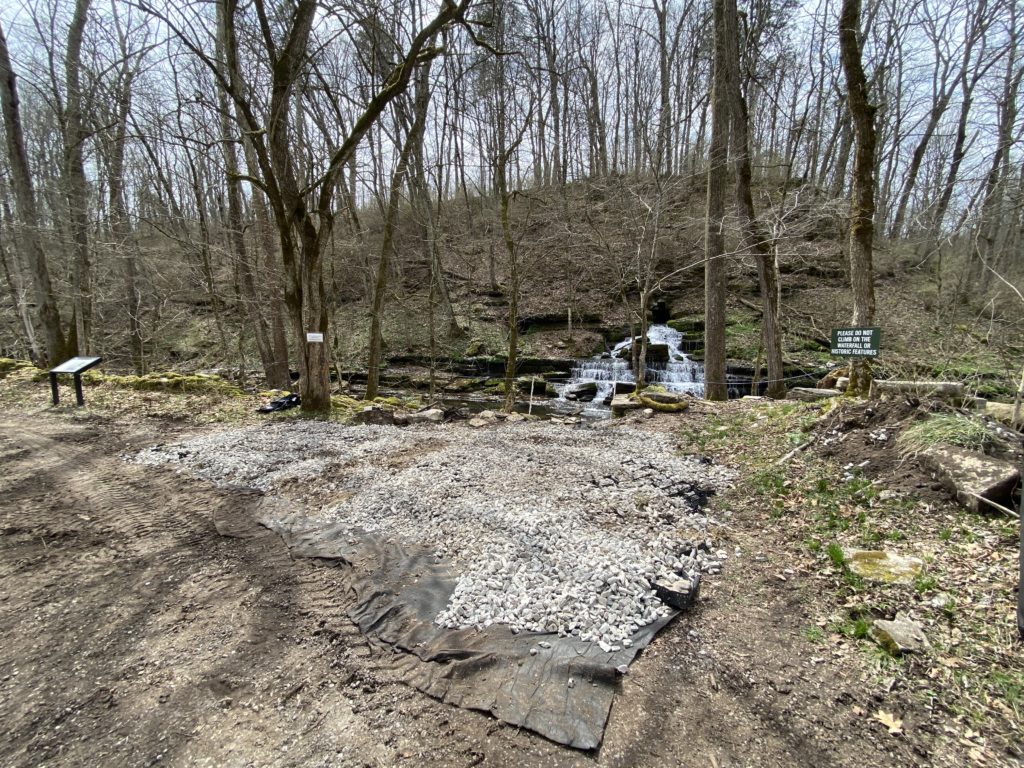
The Fulling Mill Waterfall and associated mill ruins, located north of the West Lot along the Shawnee Run Trail, stands out as the most popular destination on the entire 37-mile multi-use trail system. A result of the karst topography of the Bluegrass region combined with Shaker ingenuity, this naturally occurring spring, fed by rain and runoff from up to two miles away, powered the Shaker textile industry in the 1820s. Today, we see the ruins and spring over more than 100 years since it was last in use and recognize it as a site of both archaeological and ecological importance.
As a consequence of the site’s popularity and proximity to the West Trailhead, the area around the Fulling Mill had degraded over the last several years, including the trail, the creek and the slope surrounding the spring. After conducting a system-wide inventory and assessment of the trails we prioritized this area for upgrades and repair with work beginning March 8, 2021.
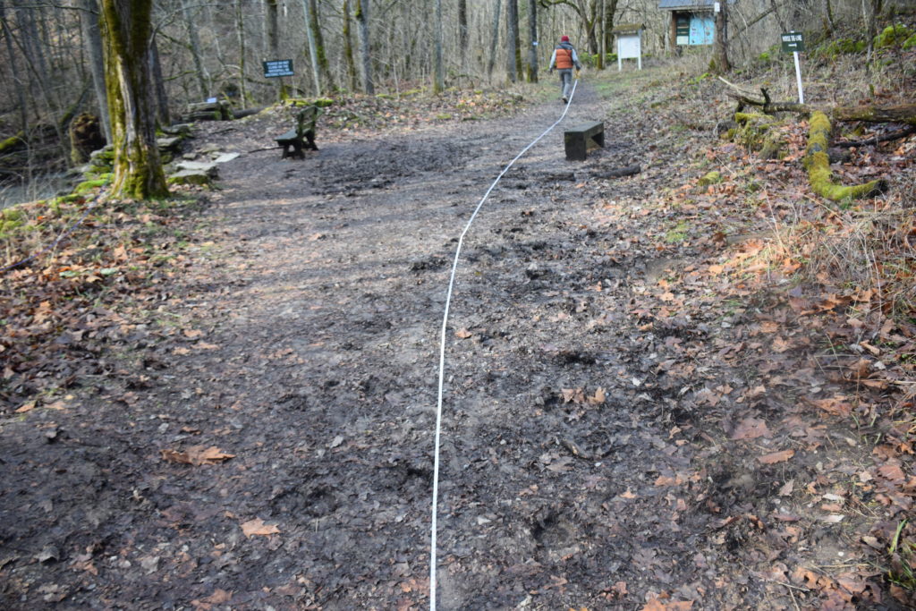
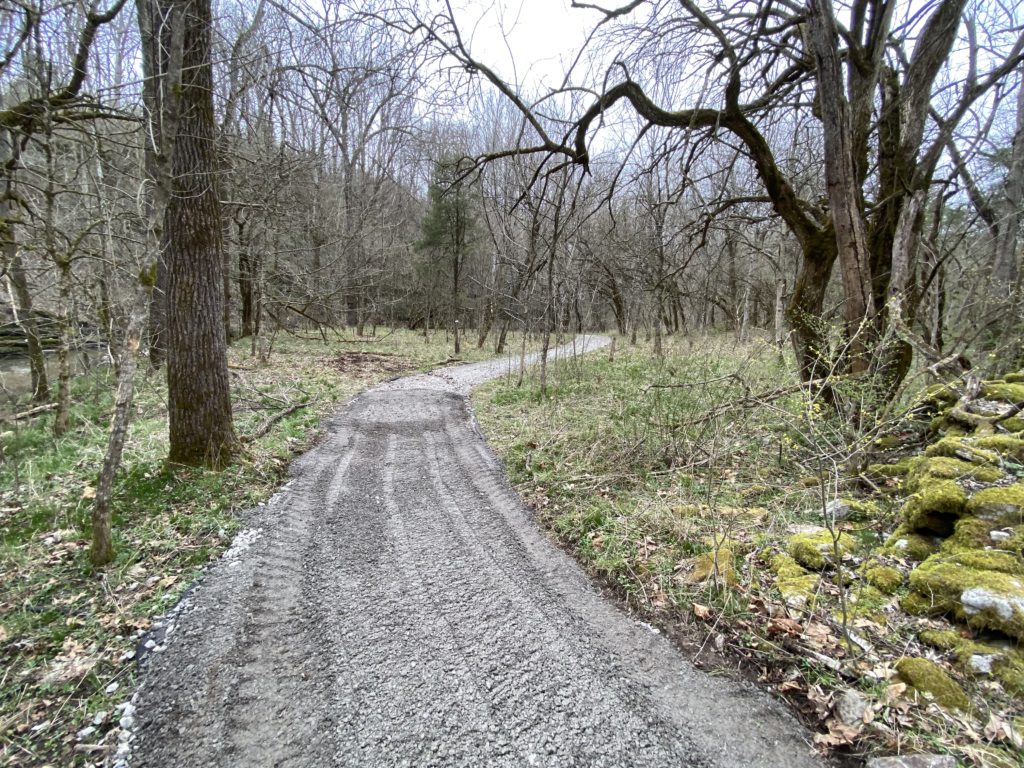
Our upgrade and repair work followed national trail building guidelines put forth by The National Forest Service and National Park Service among other sources. We paid special attention to the viewing area along the trail directly in front of the spring since it is a popular photo spot for both hikers and equestrians. This area had become extremely muddy, contributing to excess silty runoff into the creek, as well as making an unpleasant spot to stand. We installed a modified French drain or “gravel burrito” to capture and slow the runoff, and topped it with geotextile fabric (the same used in road construction) and geocells to hold the gravel in place. The rest of the trail was repaired using the geotextile fabric and gravel.
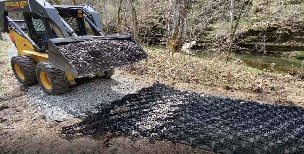
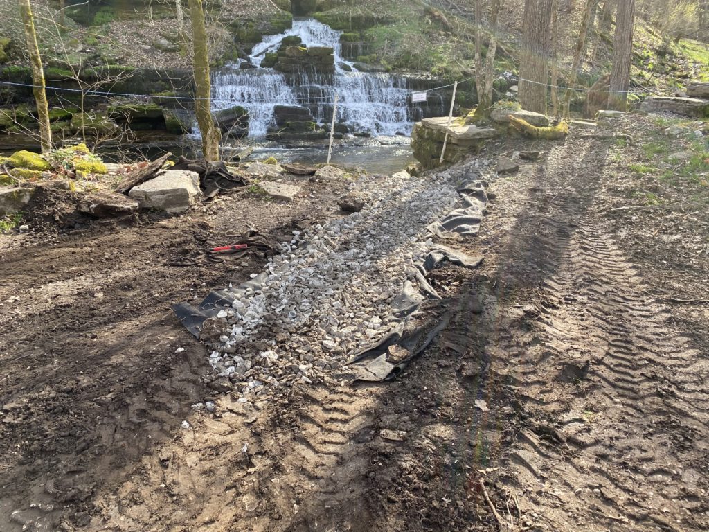
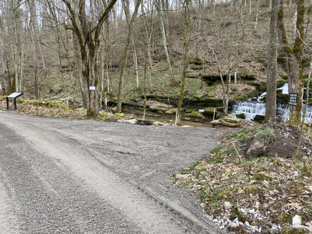
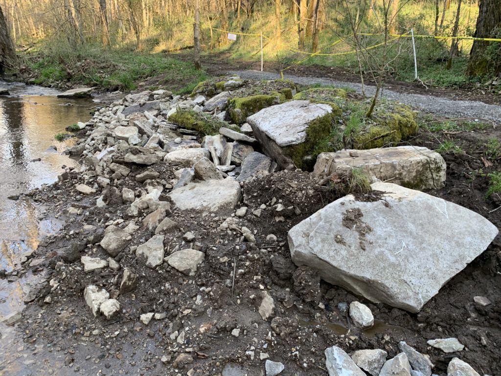
The creek crossings bookending the trail through the Fulling Mill area were also improved. Again, using national trail building standards, we reinforced the upstream and downstream sides with a combination of gravel, native stone and dead woody material. Geocells, fabric and gravel were used on the crossings themselves to decrease runoff and help hold the gravel in place during rain events.
We’re not done working on the area as there are always improvements to be made, but we feel as though we are off to a good start. Each and every visitor to the Fulling Mill site can help us protect this sensitive area by:
- Staying on the trail
- Observing and following signage
- Practicing Leave No Trace principles (if you pack it in, pack it out)
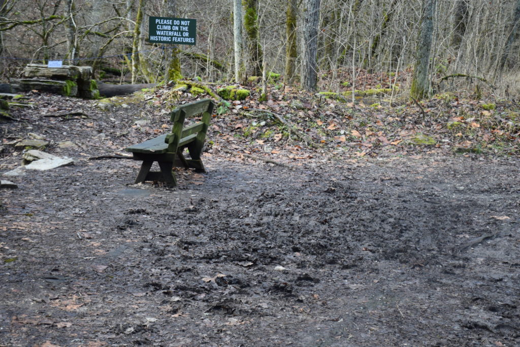
- Avoiding climbing down to the creek or up on the waterfall
- Using the restroom before going on trails (nobody wants to clean that up)
Special thanks to Brandon Wilson, William Updike and Monte Kelley for their help and support for this project. Funding was provided by Tirbracken Green Foundation and a load of gravel was provided by Fort Harrod Backcounty Horsemen.